

Navisys
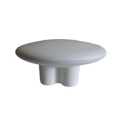
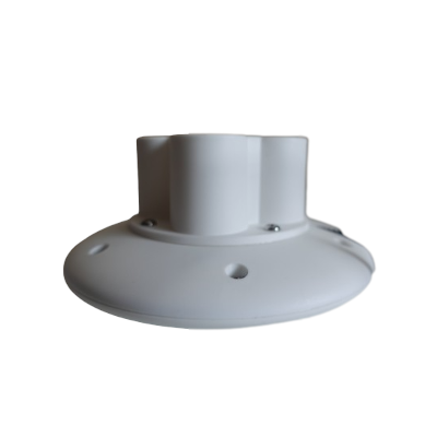
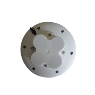
Navisys GR-9028 Portable RTK Base Station (Stream to a NTRIP Caster via the included iOS / Android App)
Navisys GR-9028 Portable RTK Base Station (Stream to a NTRIP Caster via the included iOS / Android App)
Country of Origin: Taiwan
Couldn't load pickup availability
Are you tired of expensive NTRIP service subscriptions? Frustrated with distant NTRIP mount points that compromise your RTK rover's accuracy? The fix might be simpler than you think. Say hello to the Navisys GR-9028 Portable RTK BaseStation. Set it up in just 5 minutes, skipping the headache of complex installations. Not only is this solution user-friendly, but it's also super budget-friendly. If you've got a smartphone, your very own NTRIP mount point by a GR-9028 for just C$939.

How does NTRIP RTK work?
NTRIP RTK technology combines the efforts of an RTK base station, an NTRIP caster, and an RTK rover to achieve centimeter-level accuracy in positioning. Here's how they work together:
- RTK Base Station: The RTK base station is set up at a known, precisely surveyed location with known coordinates. It receives signals from GNSS satellites and calculates the difference between the observed and actual positions. It then generates correction data that compensates for errors caused by factors like atmospheric conditions and satellite clock discrepancies. This correction data is transmitted to the RTK rover in real-time.
- NTRIP Caster: The NTRIP (Networked Transport of RTCM via Internet Protocol) caster acts as a communication intermediary between the RTK base station and the RTK rover. It receives the correction data from the base station and streams it over the internet to the rover. This allows the rover to access correction data even if it's at a considerable distance from the base station.
- RTK Rover: The RTK rover is a mobile device equipped with a GNSS receiver that tracks signals from satellites to determine its position. It also receives the real-time correction data from the RTK base station via the NTRIP caster. By combining the signals from the satellites and the correction data, the RTK rover calculates its precise position with centimeter-level accuracy. This process happens in real-time, providing instant and highly accurate positioning information.
The interaction between these components enables the RTK rover to achieve cm-level accuracy by continuously receiving and applying correction data from the base station. This correction process corrects for various error sources, resulting in significantly improved positioning accuracy compared to standard GPS or GNSS systems. The entire system operates seamlessly and in real-time, making it valuable for applications such as surveying, construction, precision agriculture, aviation and navigation.
How does the GR-9028 NTRIP data flow?

The diagram above illustrates how the GR-9028 NTRIP RTCM correction data flows.
In RTK Base section:
The GR-9028 gets positioning data from GNSS satellites and creates RTCM correction data streams. Through the "BLERTK" app on an iPhone or Android phone, it sends these correction data to an NTRIP caster in the internet.
In NTRIP Caster section:
Nowadays, you can easily access free internet NTRIP casters(For example: GeoAstra NTRIP Caster). If necessary, you can even set up your own NTRIP server – we have detailed instructions for this. The NTRIP caster makes the NTRIP RTCM correction data available on the internet.
In RTK Rovers section:
RTK rovers, like the TOP608BT RTK GNSS receiver, the Navisys GR-9029 RTK GNSS data logger or any other RTK rover devices, can fetch these correction data streams from the internet. When combined with the GNSS satellite positioning data received simultaneously, they achieve centimeter-level positioning accuracy.
Deploy Anywhere:
Why settle for limitations when a world of unlimited possibilities awaits? The Navisys GR-9028 empowers you to conquer tough terrains, unreachable spots, and remote areas.
With its built-in rechargeable battery, providing up to 6 hours of runtime, the GR-9028 becomes your reliable mobile RTK base. You no longer need to rely on power outlets. Need more operating time? Just connect it to a USB power bank.
Effortlessly transform any location into a strong NTRIP mount point, all from the palm of your hand. Whether you're in the field, at a construction site, or boldly exploring uncharted territories, the Navisys GR-9028 ensures consistent precision.
The performance of your RTK rover depends on a nearby and dependable base station for accurate correction data. The GR-9028 Portable RTK BaseStation can be quickly deployed near your rovers. With the Navisys GR-9028, achieving centimeter-level accuracy anywhere is practically effortless.
Seamless NTRIP Caster Integration
Streaming your RTK correction data has never been simpler. The GR-9028 effortlessly connects to internet NTRIP casters through your iOS or Android device. Nowadays, many free NTRIP caster services are available online (such as GeoAstra NTRIP Caster). All you need to do is register, which only takes a few minutes. Once registered, you can easily start streaming NTRIP correction data from the GR-9028 to any of these free internet NTRIP caster mount points. This allows your RTK Rover device to utilize your very own RTK base station and NTRIP service, ensuring precise centimeter-level positioning.
Join the RTK Evolution
Step into the future of RTK positioning with confidence. The Navisys GR-9028 Portable RTK BaseStation empowers you to break free from constraints, offering a seamless, cost-effective solution that puts you in control. Experience the convenience of rapid setup, the flexibility of personalized NTRIP casting, and the unmatched accuracy that only the GR-9028 can deliver.
Prerequisite:
IOS or Android device with internet access.
(Internet access is required for streaming NTRIP correction data to an internet NTRIP caster.)
Setup your own RTK Base anywhere in 5 minutes:
To utilize the GR-9028 portable RTK base, users need to initially download the free "BluetoothLE_RTK" app from the App Store or the "BLERTK" app from Google Play.

Open the BLERTK app.
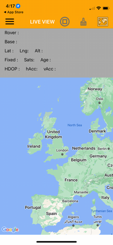
Tap the hamburger icon to open the menu.
In the Base Source section, choose "Base Setting," then select "Bluetooth LE" as the base source. Connect to the GR-9028 device named "RTKBASExxxxxxx." Set the survey-in duration to 30 seconds and the Accuracy to 3000mm. Make sure to enable the "survey-in when connected" option.
For the "OUTPUT" section, opt for "NTRIP Server" and input your NTRIP caster mount point settings.

You're all set with the necessary settings. These settings only need to be inputted the first time. In the future, whenever you wish to use the RTK Base station and the NTRIP service, simply place the GR-9028 in your desired deployment location and power it on.
It's advisable to position the GR-9028 under an open sky without obstructions like trees or buildings. Ensure that your mobile phone running the BLERTK app is within a range of 100 feet from the GR-9028 device.
Turn on the "connect" switch in the hamburger menu. You'll observe the "Base Accuracy" reading in the center of the screen. After about a minute or two during the “BLE_SURVIN” phase, this reading will stabilize. Your GR-9028 RTK base station status will then change to "BLE_BASE."
Your GR-9028 portable RTK Base is now up and running. Your rovers can connect to it via NTRIP, enabling them to achieve centimeter-level accuracy positioning.
Technical Spec:
Supported GNSS Constellations:
GPS/SBAS/QZSS (MHz):
- L1 C/A (1575.42)
- L2C (1227.60)
GLONASS:
- L1OF (1602 + k*0.5625, k = -7,…,5,6)
- L2OF (1246 + k*0.4375, k = -7,…,5,6)
Galileo:
- E1-B/C (1575.42)
- E5b (1207.140)
BeiDou:
- B1I (1561.098)
- B2I (1207.140)
Position Accuracy:
(RTK baseline up to 20km; 24 hours static)
Horizontal:
- RTK: 1 cm + 1ppm CEP
- SBAS: 1 m CEP
- PVT: 1.5 m CEP
Vertical: (result with 1km baseline)
- RTK: 1 cm + 1ppm R50
Velocity Accuracy:
<0.05 m/s (speed) GPS+GLONASS/BDS
<0.3° (heading) GPS+GLONASS/BDS (50% @ 30 m/s for dynamic operation)
Time Pulse Signal:
0.25Hz...10MHz
RMS: 30ns, 99%: 60ns
Time To First Fix (TTFF):
Autonomous (All at -130dBm)
- Hot start: 2sec (GPS+GLONASS+Galileo+BeiDou)
- Aided start: 2sec (GPS+GLONASS+Galileo+BeiDou)
- Cold start: 25sec (GPS+GLONASS+Galileo+BeiDou)
Sensitivity:
GPS+GLONASS+Galileo+BeiDou
- Acquisition: -148 dBm
- Reacquisition: -160 dBm
- Tracking & navigation: -167 dBm
Max. Update Rate:
- GPS+GLONASS+Galileo+BeiDou
- GPS+BeiDoui
- GPS
- RTK: 8Hz@a, 15Hz@b, 20Hz@c
- PVT: 10Hz@a, 25Hz@b, 25Hz@c
- RAW: 20Hz@a, 25Hz@b, 25Hz@c
RTK Convergence Time:
<10s@a&b, <30s@c
Depends on atmospheric conditions, baseline length, GNSS antenna, multipath conditions, satellite visibility and geometry
Max. Altitude:
50,000 m
Max. Velocity:
500 m/s
Protocol Support:
- NMEA 0183 up to v 4.11, ASCII
- GGA, GLL, GSA, GSV, RMC, VTG, TXT
- UBX: u-blox proprietary, binary
Default Settings:
RTCM 3.3 messages output:
1005 (Stationary RTK Reference station ARP)
1074 (GPS MSM4)
1077 (GPS MSM7)
1084 (GLONASS MSM4)
1087 (GLONASS MSM7)
1094 (Galileo MSM4)
1097 (Galileo MSM7)
1124 (BeiDou MSM4)
1127 (BeiDou MSM7)
1230 (GLONASS code-phase biases)
Augmentation System Support
QZSS: Support L1S SLAS
Correction data broadcasted on L1
SBAS: WAAS, EGNOS, MSAS, GAGAN
DGNSS: RTCM 10403.3
RTCM 3.3
Dynamics:
< 4g
BLE Data+ - nRF52832:
Band: 2.4 GHz ISM
Data Rate: 2 Mbps and 1 Mbps Bluetooth LE
Output Power: Programmable: +4 to -20 dBm in 4 dB steps
Sensitivity: -96 dBm Bluetooth LE 1 Mbps, -89 dBm Bluetooth LE 2 Mbps
RSSI: 1 dB resolution
Link Budget: 100 dB
Environmental Data:
- Operating temperature: -40 ~ 85℃ (except battery: -10~60℃)
- Storage temperature: -40 ~ 85℃
- Waterproof: IPX7
Mechanical Data:
- Φ116*24.6 (mm) for disk without pedestal
- Φ116*56.8 (mm) for disk with pedestal
- Magnet inside pedestal for fixing
- Fixing screw holes, bottom of disk
- E.g. to fix the pedestal (magnets embedded) via screw holes (GR-9028Q).
- Mount GR-9028Q on a tripod.
- Control cable lengths by default 70cm which could be customized based on MOQ.
Other Data (For Indicative Reference Only):
Working time: 6 hours, fully charged new device
Charging time: 1.5 hours with 2A charger
BLE distance: 36m line of sight
Interface
USB type-C connector for charging
Button
- Power on: a tapping for power on
- Power off: hold until LED OFF
In The Box:
- Navisys GR-9028 Portable RTK BaseStation
- USB-C Charging Cable
Product Resources
Official Documents:
User Guides:
YouTube Videos:
Software Downloads:
(To download the app for iOS or Android devices, simply click the link below that corresponds to your device.)


How to Articles and Blogs:
Tech Support Topics and Forums: